Monday, March 30, 2015

Ironhead


Somewhere deep in the Everglades is a small bay that some folks refer to as "Ironhead Bay". As with many nicknames of specific locations in the Everglades, many may not know from where such a name was derived. At best guess, someone noticed a strange looking bird with a large beak and a head that looked like a metal helmet and named the bay after it.


Ironhead is a nickname for one of the Everglades' cherished birds, the wood stork. Notoriously, it is the health indicator of the Everglades having been on the endangered species list for decades, but recently downgraded to threatened status. What makes them an indicator species? They rely on a specific type of ecosystem for survival. The Everglades provides their necessary habitat which is marshlands located in a subtropical region, has a wet and dry season and provides freshwater fish for food. The wood stork requires low water levels to find its prey that are trapped in small pools. If the wood stork cannot find adequate food, it does not nest.


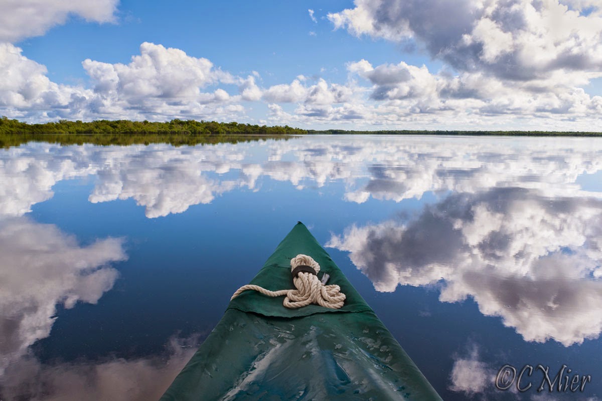
I write about the wood stork here because they have appeared on my radar more often than ever. For the past couple of years, I have had an increase in wood stork sitings. For many years, I never saw a wood stork as I paddled around the Ten Thousand Islands area of the Everglades. Now, I see them frequently soaring across the sky. In my experience, there are three types of birds in the Everglades that soar high above; vulture (turkey and black), white pelican and wood stork. Each one is quite distinguishable from the other although the white and black feathers of the wood stork can look like a white pelican from a distance. But what allows me to identify the wood stork is its long curved beak. As I observe the flying wood stork while paddling through rivers and bays that are surrounded by dense mangrove forests, I am reminded that there are large freshwater marshes behind those mangroves. This is where the wood storks will reside most of the time and the reason I see them flying above.

I also notice wood storks as I drive the Tamiami Trail or Ingraham Highway. Wood storks do not always soar high above but can be seen 30-40 feet above the ground as they cover a short distance from one roosting spot to another. This is when it is easy to mistake them for another homely looking bird, the white ibis. Both have long curved beaks, and both have black tips on white wings. But the difference is in overall size of the bird. The wood stork stands over 3 feet and has a wingspan of about 5 feet. The white ibis is about half that size.


I have had the good opportunity to photograph the wood stork, but only a handful of times and in very distinct areas. Of course the Anhinga Trail offers wood stork photo opps, up close and personal such as this one of an adult.


A juvenile wood stork is distinguishable from an adult. The first time I saw a juvenile wood stork was during a camping trip where I spent some time in and around Gopher Creek in the Everglades. In this rich marshy area, many wood storks reside, and here are two images of a youngster.


Notice the head of the juvenile does not have that rough armored exterior and even sports hairlike feathers on its top. Their young feathers also appear darker than the adult feathers. The next image below includes both juvenile and adult birds, photographed at Shark Valley.


On Biscayne Bay, I photograph mostly egrets and herons feeding in the saltwater (when not seriously polluted by freshwater run off) shallow grass flats. But on occasion, I spot different bird species. Most of these anomalies have occurred only one time. For instance, on a December morning in 2008, I found a small group of wood storks along the mangrove shoreline. That was the last time I saw a wood stork on Biscayne Bay. Here's one image from that day.


Wood storks are not exactly the most photogenic bird out there. Maybe it is for that reason I love to photograph them. It goes without saying that the photo darling among Florida birds is the bright pink roseate spoonbill. Ironically, I view the image below of a group of wood storks and see the roseate spoonbill as a photo bomb. Yes, it adds color to the scene and yes, it does detract from the drab appearance of the wood stork. I admit, I kept it in the frame for a reason.


Look at a wood stork and tell me they are not endearing? At the very least, appreciate their presence in the Everglades and know that their survival is totally dependent on our stewardship of this fragile ecosystem. Here are a couple of interesting facts about these beautiful birds:
  • They are the only storks in North America that nest
  • They catch fish by "feel", holding their bills open until a fish is touched
  • Reflexively, the bill closes within 25 milliseconds, the fasted known among vertebrates
  • A breeding pair requires about 440 pounds of fish per breeding season
  • In the 1930s, the Everglades supported nesting populations of 5,000 to 15,000 pairs
  • In the 1960s, increased development of water-control structures reduced the number of birds and by 1995 fewer than 500 pairs of Wood Storks were nesting in the Everglades.
  • Restoration of the Everglades is expected to allow an increase in the number of wood storks


Wednesday, March 18, 2015

Photographing the Bill Ashley Jungles: Part 2


Back in the day when skiffers would explore these areas, the jungle could get very dense, making small waterways impassable. One way to clear out areas was to burn. Burning small areas for a few minutes to a few hours accomplished several things; it cleared the area for passing, provided a landmark for navigational purposes, improved the nutrients necessary for animals and normal growth of flora (think prescribed burning), and it gave the hunters a greater advantage (for better or worse). So in a way, before the park service, the gladesmen were the wildlife managers.

The gladesmen learned this amazing landscape without the benefit of GPS. Before GPS, few people would wander into the convoluted areas, except for a few fishermen such as Herman Lucerne. Now, with a satellite image and GPS (yes, even an iphone will do the trick!), one can navigate their way through the maze of mangroves and water, without a prescribed burn. It is still a bit unnerving to take yourself off the chart so to speak because this landscape is as monotonous as monotony can get. It is terribly easy to get turned around in there; you must be 100% confident that your GPS will get you in and out. Or at the least, be 100% confident in your paper satellite map and compass reading skills.

After paddling through the Hells Bay Trail, you enter into an area that is more open. Large and small bays intermingle with narrow waterways that randomly wander in and around mangrove islands. If you look at a satellite image, it may remind you of a doily pattern, except without a pattern. Some may find the monotony of the area offputting, but for the explorer, it is an amazing place. From a photography perspective, it just taunts you to try and capture its subtle beauty. And so this past weekend, I tried to do just that.


Once off the trail and into the open, I immediately noticed how the waters were exceptionally low. In certain parts, this revealed clumps of tangled and thick seagrasses, as you can see below. I immediately noticed an opportunity to include some interesting foreground to balance out the thick clouds in the sky. You see, in these parts, foreground matter is hard to come by. It's only water and sky separated only by a thin line of mangroves.


With a circular polarizer on my lens, I anchored in the thick seagrass which kept my boat from moving. The wind was blowing across the water, making it near impossible to avoid water ripples, as you can see here. While the polarizer filter does a great job during midday hours, I was not totally happy with the water disturbed by the wind. I much prefer a smoothing effect that comes with a long shutter speed.


After setting up camp on the chickee, I headed out to explore some areas. I wanted to experiment with something. As it was midday, the sun was high above; not ideal for waterscape photography. However, I thought I could defy that and go about my business of photographing despite the challenging light. After all, I saw great potential with the clouds and the grasses.

I looked for some scenes that might work with an interesting foreground. I noticed a small meadow of widgeon grass (my best guess) that was lit up nicely by the high sun. I anchored my boat using two stick it anchor pins. On the front and back thwarts, I attached two small ropes each with a loop only big enough to allow the stick it pin through. Each one was only long enough to allow the loop to hang over the gunwale. One was placed behind me on the left side and the other in front on the right side.  By doing this, the stick it pins were solid against the boat, making it unmovable. Next, I set the tripod in the water along side the canoe and locked the camera in place. Two of the tripod legs were flush with the canoe, allowing me to be as close to the camera as possible. I am always extra careful to make sure the tripod legs are as deep in the mud as they will go.

I then played with horizontal and vertical compositions and found a good exposure to capture the entire scene (with slightly blown out clouds) without the need to bracket and later, blend multiple exposures. I used the lowest ISO setting and set the aperture at f11. Next, I added the neutral density filters (not graduated) for a total of 6 stops. This slowed the shutter speed to 1 to 1.6 seconds, enough to smooth out the water that was disturbed by the wind. Here is one image, taken around 1 pm.


What I liked best about the image was the blurred effect on the grasses (although the angled one in the left bottom corner is a bit obstrusive). My experiment appeared to be going well. I continued exploring and found a small mangrove island that reminded me of a space ship. It's symmetrical contours appealed to me as the clouds and their reflections surrounded it. The trick was positioning my boat so I could isolate the island from other nearby trees. Once I got in place, I set up the tripod again. This time, I tried bracketing exposures and also paid closer attention to the cloud formations.  Here is one result.


By the time I finished with the island, it was about 2:30. I had been on the water since 8 am. The temperature was in the mid to high 80s and I was feeling the fatigue of it. As I headed back to the shade of the chickee, I checked out some places very close to camp. I wanted to get back out on the water near sunset and try my experiment again, this time with some sky color. Here's one more image, taken with the polarizer filter and no tripod. I actually like the ripples in the water on this one. Note the osprey photobomber in the middle between two clouds.


Well, I did not go back out that evening, but instead, waited until morning to see what the sky had to offer. From the chickee, the sun rises almost directly to the left. However, with enough clouds, this can provide a beautiful scene with the side light and colors on the clouds reflecting on the large bay. Here's a couple images taken before I broke camp. During the paddle back, I began strategizing my next visit to the Bill Ashley jungles with a renewed interest. Once again, the Everglades is all new to me.


Tuesday, March 17, 2015

Photographing the Bill Ashley Jungles: Part 1


Few people have heard of the Bill Ashley Jungles. Gator hunters, moonshiners and skiffers lived in these jungles several decades ago before the area became part of the Everglades National Park. Apparently, the jungle was named after an outlaw and his gang that lived there to hide from the law. That's the short of it. You can read all about it in one of the best books concerning the history of the Everglades in The Gladesmen, a semi-autobiography about Glenn Simmons.

Now-a-days, we paddle and camp in the Bill Ashley Jungles where there are several chickees built by the national park. There's Lane Bay, Hells Bay and Pearl Bay chickees and several more to the north on the larger confluence rivers such as Roberts and Shark Rivers. There's also a small ground site called Lard Can, where hunters made a camp long ago. Apparently, lard cans were quite useful for storing things.


 At any rate, we head into this area via the Hells Bay Trail whenever the winds are high and we don't want to be exposed in open waters. The trail, marked by the park runs through the mangrove jungles in a manner best described by Glen Simmons, "That trail twisted and turned worser than any snake". It is so well protected by mangroves you can barely make it out on a satellite image such as the one below. The "X" on the bottom marks the launch site from the Ingraham highway.  The "X" on the top marks the end of the trail as it feeds into the larger bays. The distance as the crow flies is about 1 3/4 miles; but the actual paddle distance is closer to 3 miles.


I have been paddling the Hells Bay Trail for several years, typically no more than 1 or 2 times in one camping season. But this year, we've gone up in there three times. For me as a photographer, these trips are far from being successful and I mostly don't get excited about going. Sure, I can capture a sunrise or sunset over a large bay from one of the chickees. A photograph of the chickee itself can be nice, like this one taken on Pearl Bay last year.


While the mangrove jungle is extraordinarily appealing for the exploration of it, I simply have not grasped a way to capture it as most images look pretty much the same. Let's start with the Hells Bay Trail. In the morning, the lighting is quite nice and because we often paddle in the winter under clear blue sky, the mangroves offer lots of highlights and shadows. While traveling, snapshot images can offer you a glimpse of what the trail looks like, but not much more than that. Here's one image. Notice the PVC pipe that serves as a marker. As many times as I have paddled here, I still rely heavily on those markers and on occasion find myself searching hard for one. But dang if they always seem to show up when I want to capture an image!


While I find the entire area to be beautiful in its own way, capturing it has simply eluded me. Low lying trees prevail. There is very little color other than green and brown among them. Open bays are surrounded by a thin line of mangroves and the remaining view is sky. Without clouds, its a minimalist's dream come true. See for yourself here.


So on this last trip to Pearl Bay, I entertained the idea of not bringing any photo equipment. But I did anyway because I could not bear going anywhere in the Everglades without it. And then something happened during this trip  that was an inspirational breakthrough. And I have the clouds and low water levels to thank for that. During my short time there, I allowed myself to experiment which resulted in some different images I am very pleased with. But mostly it peaked my level of inspiration for this area. I will re-visit the jungles with a fresh vision and will never ever consider not bringing my camera.

I write this blog in two parts. Here, I introduce you to the Hells Bay Trail that led me to the area where I experimented. So for now, below are two images taken on the trail during the most recent trip. There is a landmark on the trail where a clump of paurotis palms grow tall. The morning light hits them just right and I have always looked forward to seeing them as I paddle through, and I have always wanted to photograph them. With the help of the clouds, these images portray the Hells Bay Trail in a way I looked forward to doing for a long time. The palms stand out and with the nice front light and clouds in the background, they are lovely.


Next time, I will introduce you to the Bill Ashley Jungles and how I captured waterscape images at midday and with a slow shutter speed.
PS See if you can find the chickee in the image at the very top.

Wednesday, March 11, 2015

Clouds in my coffee


"Here are no lofty peaks seeking the sky, no mighty glaciers or rushing streams wearing away the uplifted land. Here is land, tranquil in its quiet beauty, serving not as the source of water but as the last receiver of it."  President Harry Truman"s Address on Conservation at the Dedication of Everglades National Park, December 6, 1947.

I was thinking about clouds this morning. If you pay any attention to landscape photography, you might notice that certain elements make a strong image. Color and lighting of course, water reflections, strong foregrounds,  mountains, and clouds to name some. I did a quick experiment, I went into 500px website and brought up the Editor's Choice for Landscapes. If you scan through the first 40 images, you'll find clouds to be a significant and many times the primary element of the image in 20 of those images.

Here in south Florida, the land is flat, there are no mountains or valleys. But it has clouds and wow, does it ever. Now, google search "Landscape photography Everglades". The two artists that will likely appear are Clyde Butcher and Paul Marcellini. Check out there images and you will find lots of clouds.

I've always liked to see clouds in my images taken while on the water or on a beach. But lately, I've been more critical of my images and have become more choosy when looking for images to take, all in the context of clouds. There are several ways clouds can improve an image. One obvious way is that they add texture and shapes to the sky. Here's one from Biscayne Bay as an example.


I often use clouds when photographing at the bird rookery where the sky forms the background. Darkish clouds on the western horizon that are lit up by the rising sun in the east really gives an interesting background to the white birds as seen here.


Clouds can add balance to a composition. You may have a strong foreground, maybe a tree in the middle and behind it the sky. Clouds can complement each of the strong elements in the image by filling a void.  Here are a couple examples.


During sunrise or sunset, clouds add color. So for those beach scenes that may or may not have strong foregrounds in them, I pray to the cloud gods. Here are a couple views at sunrise on Biscayne Bay and another at sunset in the Ten Thousand Islands. When I am in the Ten Thousand Islands, it is to camp, which means I am out there only during winter months. Winter skies in the Everglades can often be cloudless, so I pray a lot.


Maybe the most pleasing way of using clouds in an image is with water. Here in south Florida, you can capitalize on that. Wide open waterscapes prevail and the reflections are endless. Here are two examples.


Of course, storm clouds are a bonus and can make the entire scene. Dramatic clouds are almost always something to be thankful for when photographing. While I do not like paddling my canoe with an approaching storm, sometimes, they get close enough to capture. Here are a couple examples, the top from Biscayne Bay and the other from the Everglades.


I once heard a talk given by Clyde Butcher. He said in order to get a shot, he would often wait hours for the clouds. You may not want to do that, but always look to the sky and pay attention to weather forecasts. Once you focus more on clouds, the possibilities will open wide.


Monday, March 2, 2015

Two Nights in the Everglades: Tiger Key


My first night on Picnic Key began with a brilliant sunset. It had been a day of varying cloud and fog conditions that ended brightly before night set in. After a restful sleep, I woke to hear the low rumble of the crab boats heading out the channels, indicating the pre-dawn hours had begun. It was almost like music to my ear as I lie awake in my cozy tent. I began to gather up my gear and eat breakfast as sunrise approached. This was a lazy morning as I did not need to be on the water at any particular time having only a mile or two to paddle to Tiger Key. I would take my time and paddle around the large Picnic Key, attempt to set up camp early on Tiger and then spend the remainder of the day scoping the beach for dusk photography.

As the sun rose behind the beach, a haze of clouds formed on the western horizon. With the calm incoming tide, it looked mesmerizing to me, so I captured a few images, such as this one.


I walked the beach a couple times, looking at animal tracks. A couple of them seemed odd and I finally concluded that they were dog tracks, unwelcome animals in the park. But, people bring them anyway. By 9 am, I had dismantled the tent amidst the no-see-ums, packed the boat and headed out slowly around Picnic Key. By that time, the sky was mostly cloudless. I followed a couple dolphin for the longest time and while they are frequent companions out here in the gulf, I rarely get a shot of them, or at least one that I care to brag about. They were mostly in good light and after awhile, I caught on to their routine. This allowed me to get rather close to them as they worked the shoreline. At one point, I was close enough to catch the violent wake from their feeding freezy. Here are a couple images, best I could do that day.


I headed over to the western shoreline of Tiger. No one was on the island. I set up camp, and around noon, I sat under the shade of my tarp eating lunch and enjoying the view. Two kayakers had left Camp Lulu Key and were paddling toward the southwestern tip of Tiger. Soon they were out of sight. A nice southwesterly breeze was coming up on shore, which is exactly what I wanted.


But then, something strange began to happen. A band of dark fog formed along the length of the southwestern horizon while a veil of clouds began to appear to the northeast. The winds increased and the sky became misty. A red kayak came out of the south end of the island and passed by as the fog gradually thickened. The wind came directly at the shoreline and brought with it a wall of mist. If I had not been on a subtropical island, the appearance of that mist would have sent shivers up my spine. It looked cold! I grabbed the camera and began to photograph the beach. Here are a couple images taken around 1-1:30 pm.


From Tiger Key's beach, one can easily see Camp Lulu. But within 15 minutes, it was completely gone, as was the kayaker that was paddling in the fog towards it. For the next couple hours, I walked up and down the beach and photographed. The scene was eerie and my visibility was not much longer than arm's length. Alone on the island, I felt a bit uneasy, but quite happy to be there. Everything looked dark and some things appeared black and white to me. Here is an image that I visualized in black and white.


As the air thickened with fog, the temperature dropped and the winds increased. If it were only fog, I would not have felt the slightest uneasiness. But the winds hitting the beach directly with an incoming tide caused a violent surf. It was not only the sight of the crashing waves, but the sound that continued into the night that made me nervous. These are not the type of waves I wanted to launch my canoe into. The sun, which was directly in front of the beach was not in sight for the remainder of the day. The day turned into night without a blink.


That evening, I sat in my tent listening to the forecast. Heavy fog was expected until about 9 am, but thankfully, it would be relatively calm with winds shifting to the south. If I waited until after 9 to get on the water, I would have to fight the outgoing tide through the channel leading back to Everglades City. If I left at 7 am as planned, I may be paddling through large waters in zero visibility, not exactly a comfortable situation. I prepared to paddle in the fog. I had my GPS with spare batteries in my pelican case. I had a headlamp, flashlight and a solar light. I had a map and compass if it came to that. And I would attach my VHF and waterproof-cased cell phone to my PFD.

I awoke before daylight and started packing and eating breakfast. By 6:30, the visibility appeared high enough that I could distinguish the sky from the water. Soon, I could see Camp Lulu, 1/2 mile away. All was well as I got onto the calm waters and began my paddle back to Everglades City. After 30 minutes of paddling, another dose of fog began to form over the eastern sky. I was in the middle of Gaskin Bay, paddling quickly to get into the creek before losing visibility.


But, the fog was gentle and passed by without a bother. Soon, I was heading across Chokoloskee Bay under clear skies and a gentle slack tide. And yet another memorable trip into the glades, and far from being the last.